
Stay informed with U.S. Weather Alerts, delivering real-time updates on severe weather conditions across the nation. From tornado warnings to flood advisories, get concise, reliable information to keep you safe and prepared.
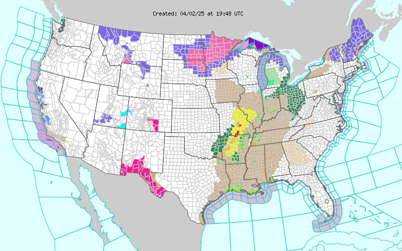
National Weather Service Latest News Headlines
- Fire Weather Concerns and Severe Weather
 on September 11, 2026 at 17:26
- Severe Thunderstorm Warning issued September 13 at 7:58PM EDT until September 13 at 8:30PM EDT by NWS Charleston WVby NWS on September 13, 2026 at 23:58
At 758 PM EDT, a severe thunderstorm was located near Elizabeth, moving east at 25 mph. HAZARD…60 mph wind gusts and penny size hail. SOURCE…Radar indicated. IMPACT…Expect damage to roofs, siding, and trees. Locations impacted include… Elizabeth, Lucille, Cherry, Freeport, Greencastle, Morristown, Walker, Petroleum, Palestine, and Macfarlan.
- Severe Thunderstorm Warning issued September 13 at 7:57PM EDT until September 13 at 8:15PM EDT by NWS Charleston WVby NWS on September 13, 2026 at 23:57
At 757 PM EDT, a severe thunderstorm was located near St. Marys, moving east at 30 mph. HAZARD…60 mph wind gusts and penny size hail. SOURCE…Radar indicated. IMPACT…Expect damage to roofs, siding, and trees. Locations impacted include… St. Marys, Belmont, Newport, Matamoras, Friendly, Arvilla, Point Lookout, New Matamoras, and Maxwell.
- Severe Thunderstorm Warning issued September 13 at 6:55PM CDT until September 13 at 7:45PM CDT by NWS New Orleans LAby NWS on September 13, 2026 at 23:55
SVRLIX The National Weather Service in New Orleans has issued a * Severe Thunderstorm Warning for… St. Helena Parish in southeastern Louisiana… Northern Tangipahoa Parish in southeastern Louisiana… Western Washington Parish in southeastern Louisiana… Southwestern Pike County in southern Mississippi… Eastern Amite County in southern Mississippi… * Until 745 PM CDT. * At 653 PM CDT, severe thunderstorms were located along a line extending from near Franklinton to near Kentwood to near Liberty, moving south at 20 mph. HAZARD…60 mph wind gusts and nickel size hail. SOURCE…Radar indicated. IMPACT…Expect damage to roofs, siding, and trees. * Locations impacted include… Liberty, Greensburg, Amite, Amite City, Kentwood, Roseland, Osyka, Darlington, Mount Herman, Wilmer, Gillsburg, Easleyville, and Tangipahoa. This includes the following Interstates… Interstate 55 in Louisiana between mile markers 47 and 66. Interstate 55 in Mississippi between mile markers 1 and 9.
- Flash Flood Warning issued September 13 at 4:53PM MST until September 13 at 8:00PM MST by NWS Flagstaff AZby NWS on September 13, 2026 at 23:53
FFWFGZ The National Weather Service in Flagstaff has issued a * Flash Flood Warning for… Coconino County in north central Arizona… * Until 800 PM MST /900 PM MDT/. * At 453 PM MST /553 PM MDT/, Doppler radar indicated thunderstorms producing heavy rain across the warned area. Between 1.25 and 2.25 inches of rain have fallen. Additional rainfall amounts up to 0.25 inches are possible in the warned area. Flash flooding is ongoing or expected to begin shortly. HAZARD…Life threatening flash flooding. Thunderstorms producing flash flooding. SOURCE…Radar indicated. IMPACT…Life threatening flash flooding of creeks and streams, normally dry washes, urban areas, highways, streets and underpasses. * Some locations that will experience flash flooding include… Tappan Spring. This includes State Route 64 between mile markers 293 and 295. This includes the following recreation areas and campgrounds… Willows Camp. This includes the following swimming holes… Tappan Spring. This includes the following creeks, washes and rivers… Lee Canyon, Burro Canyon Wash, Needmore Wash, Little Colorado River, Tappan Wash and Cedar Wash.
- Flash Flood Warning issued September 13 at 4:43PM MST until September 13 at 11:00PM MST by NWS Flagstaff AZby NWS on September 13, 2026 at 23:43
FFWFGZ The National Weather Service in Flagstaff has extended the * Flash Flood Warning for… The Havasu Creek basin in… Coconino County in north central Arizona…This includes the Colorado River between river miles 156 and 158 * Until 1100 PM MST Sunday. * At 443 PM MST, Doppler radar indicated thunderstorms producing heavy rain over portions of the Havasu Creek basin. Between 0.5 and 1.5 inches of rain have fallen. Additional rainfall amounts of 0.25 to 0.75 inches are possible in the warned area. Runoff from these storms will eventually flow into Havasu Creek and may cause flash flooding through the evening hours. HAZARD…Life threatening flash flooding. Thunderstorms producing flash flooding in and around the Havasu Creek basin. SOURCE…Radar indicated. IMPACT…Life threatening flash flooding of areas in and around the Havasu Creek basin. * Some locations that will experience flash flooding include… Little Navajo Falls, Mooney Falls, Beaver Falls, Hualapai Hilltop, Havasupai Reservation and Supai. This includes the Colorado River between river miles 156 and 158. This includes the following swimming holes… All swimming holes on Havasu Creek near Supai. This includes the following creeks, washes and rivers… Little Coyote Canyon, Sinyella Canyon, Heather Wash, Pasture Wash, Colorado River, Black Tank Wash and Havasu Creek.